
Many people think of the word “earth observation” as a knowledge discipline belonging to a research institution. However, distilling and monitoring the correct information from satellite images can also be of value to businesses and municipalities.
A lot of experience has been gained within Matrixian in working with satellite images, aerial photos, radar and lidar, in combination with open data and other information sources.
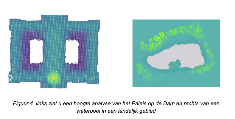
The example below shows the highlights that fall within buildings, these highlights are modeled in order to be able to accurately calculate the volume. The image on the left is the height model of the Royal Palace on Dam Square. The image on the right, for example, shows how surface water and trees can be recognized. Where surface water can be identified by the reflection of the measurement points. Trees are identified by their relative height relative to the environment.
#assets #proptech #satellite #Matrixianmap #geo #locationdata #datascience